For those that don’t know, signs like these on British roads indicate one can drive at the ‘national speed limit’, which is no less than 60mph. Anyone doing so on this road, however, may as well presume to end up in the cemetery to which it leads, visible over there on the sea shore. Perhaps the road traffic planners of Stromness, Orkney, have a morbid sense of humour. Or perhaps my using of this photo suggests that it’s just me.
Seems an appropriate shot to mark my last day here. Though, I suppose, this is a descent rather than an ascent, but never mind. Mostly, this has been an enjoyable and interesting visit, but I feel it unlikely I will ever return here.
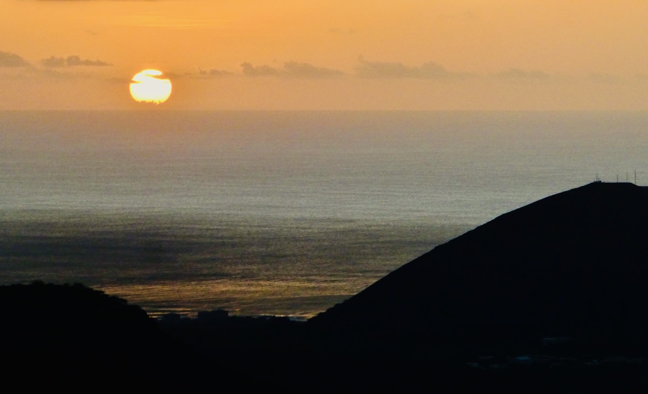
On April 11th last year I departed on my trip to Namibia, and tonight I should have been in the air again, but instead am sitting out the year’s latest flight delay and am scheduled to depart tomorrow instead. But there are worse places to be stuck, I suppose. The surf was certainly up today, one reason why none of Ascension’s glorious beaches are considered safe places to swim. In the foreground, one of the historic ‘Turtle Ponds’, thankfully no longer used — behind, Sisters’ Peak makes its second appearance.
Ascension Island is greener than I expected, although this is mainly due to the spread of an invasive weed, Mexican thorn, which authorities are trying to control (with some recent success it seems). But the peak in the centre of the island has long been known as Green Mountain for good reason. It was on this mountain that, in the 19th century, botanist Joseph Hooker embarked on a giant horticultural project to plant a forest and bring more rain to the island — and the jungle in the foreground of this shot is evidence that he succeeded. In fact, as far as I can tell this view is shrouded in cloud most of the time — some more is just visible drifting in from the right, but I nabbed the shot in a rare clear spell on my Sunday morning walk up to the island’s summit. Note also the Perfect Crater — that’s its official name — visible to the right of the cone of Sisters’ Peak.
Now that’s a change of scene: from thatched cottages to a desert island. It’s nearly a year since my research funding award and, consequently, my chance to visit Ascension Island, were confirmed, and 73 days since I uploaded the map of this place to the blog. Zoom into that image and look at the westernmost headland of the island, where you can just about see the label ‘Tanks’: those are what you see in the distance.
St Helena doesn’t have beaches, and the tourist industry of that island may well lament this fact. But Dead Man’s Beach is a stupendous swathe of sand, and right by the main settlement, Georgetown. What a marvellously evocative name it has (though it will be explained not by the shipwreck of some 17th century pirate vessel, but because Georgetown’s cemetery lies right behind it). This is not even to mention the turtles, evidence for whom lies everywhere: but they will, hopefully, be pictured on one of the remaining eight evenings that I am scheduled to spend in the middle of the Atlantic.
Ascension Island is, nominally, a dependency of St Helena and lies about 800 miles from it. Whereas there are many friends who think that when I come here (St Helena, that is) I am swanning away to some ‘desert island’, it’s not like that, as my photos make clear. But, as far as I can ascertain, Ascension really is such a place. The plan is that I will be going there in early April, all as part of the same research project that I’ve been working on since 2021.
But Ascension may well be the most bureaucratically impenetrable place I have ever tried to visit. It might be depicted on maps — this one hangs in a corner of Anne’s Place in Jamestown — but does it officially exist? In practice, can your average person actually set foot there? About these things, I am not yet convinced.
I’m sure this is one of those places of which we’ve all heard, but have never given a great deal of thought to what it might actually look like. Well — here you go. As seen shortly after take-off from Cape Town airport this morning.
Believe me, the St Helena Yacht Club is not as posh a place as it sounds. But it is certainly the best place in town to watch the sun set over the Atlantic, and on Wednesday nights there is a regular food night of some description. In early 2023 it was Taco Night — nowadays it has morphed into Fish Night. Either way, I was there early, and the guy with the impressively pointy beard is still setting up.
The dominant theme of the last few days has been sand, so it’s about time we had some local fauna on here. This is not only the first time I have ever seen flamingos in the wild, but, I am fairly sure, anywhere. Apparently over 200,000 of them live on Walvis Bay’s lagoon. This place is where I came in with Namibia, on the flight out to St Helena some 16 months ago (see this shot): compared to that, today’s picture is certainly fuller of life and rather pinker. Flamingos are pink — it’s the way they are — and they definitely seem to like each others’ company.
I was forewarned about the fogs that affect the coast of Namibia. The Benguela current sweeps cold water up from Antarctica, and as it passes the African coast it mixes with the warm air coming off the continent. But just because I understand the climatology doesn’t mean that the actual experience of the fog hasn’t come as a surprise because they really are bloody cold; the mornings and evenings here in Swakopmund have not at all been like one might imagine an African beach holiday, more like Morecambe in November. These two swimmers must be seriously hardy.