This summed up the weather today: some fine spells but the next bout of rain was never very far away. It also sums up the fact that I was at home and am going to remain here for much of the next eight weeks, so get used to photos of Hebden Bridge.
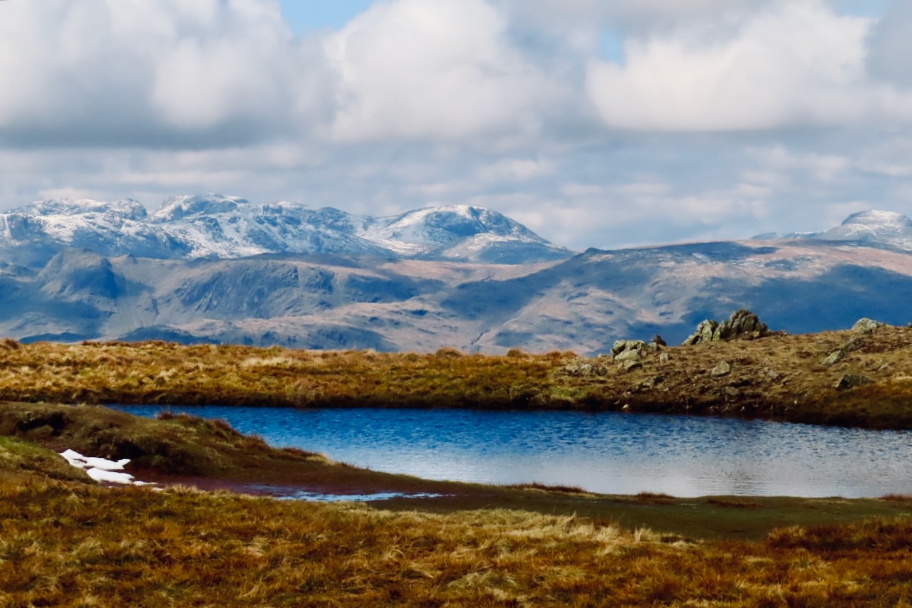
The summit known as Red Screes, with its substantial tarn, sits at 2,541 feet above sea level but is still considerably lower than the Scafells: left to right from the edge of the picture, Scafell, Scafell Pike and Great End. Great Gable pops up to the right. A fine day to be out walking even if the transport arrangements once again…. but what the hell, I expect too much perhaps. Read more on the other blog, if you like.
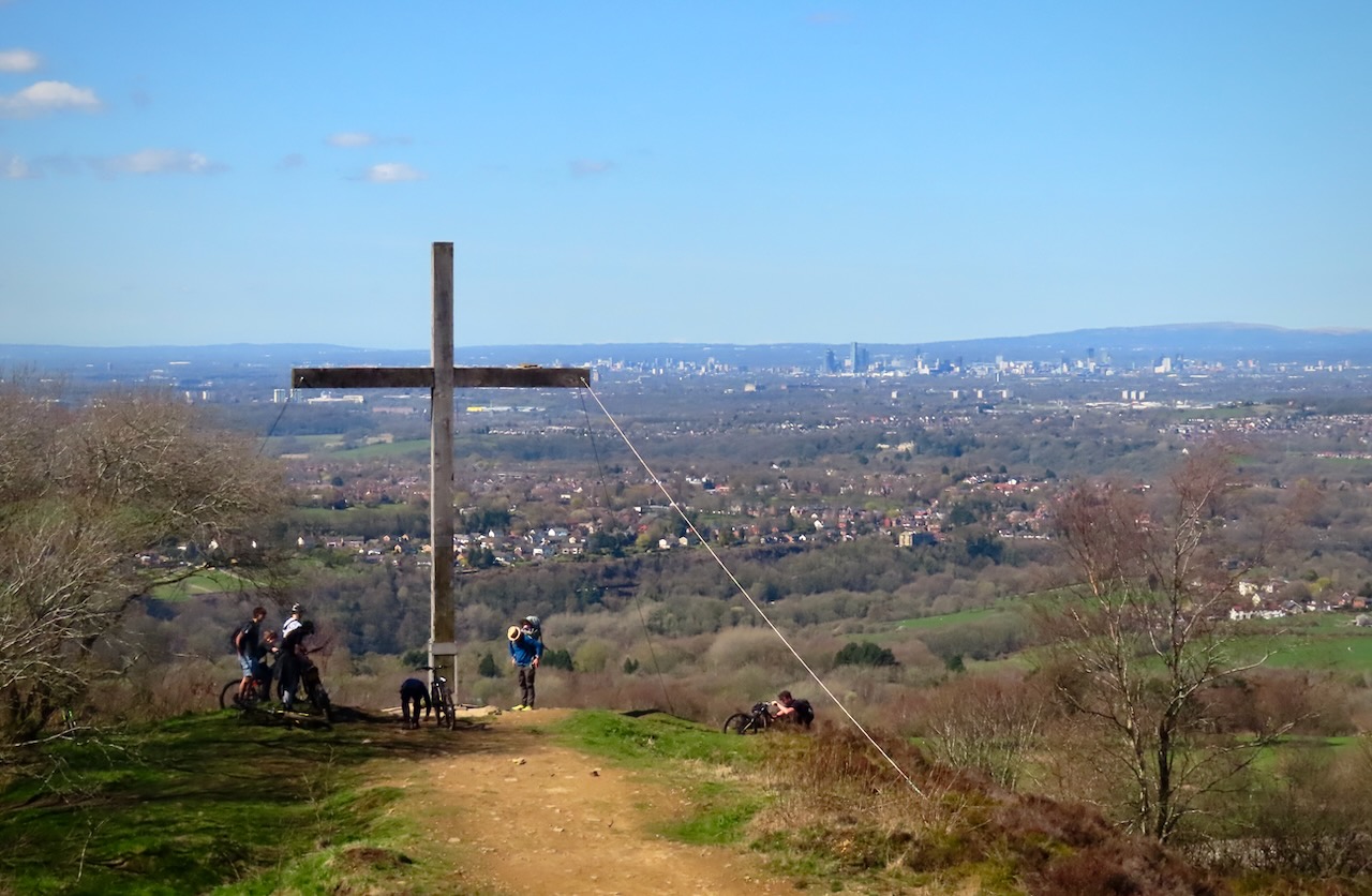
Seeing as today was Good Friday this seems an entirely appropriate post for the occasion, but I swear that until I came over a rise on Mellor Moor, above Marple, and saw this cross, I had no idea it was there — it wasn’t marked on the map. Apparently it was first erected in 1970. It has a good view of Manchester, you have to say. (Passed on my latest County Top walk — of which there are more pictures on the other blog…)
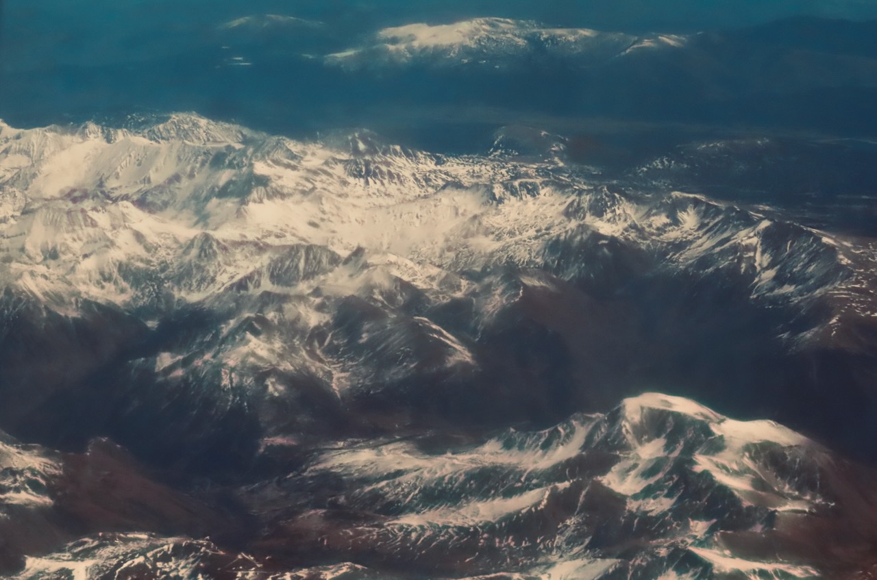
I think that, by law, and certainly by my own moral code, all aeroplane windows should be kept sparkling clean. The one I had to use on our flight home from Barcelona was noticeably grubby, so apologies for the ensuing blemishes on this shot (I know they’re there). Still, the view was good, at least while we were crossing the barrier between Spain and France, that is, the Pyrenees: mountains I have never visited, but they’re on the list. Named, apparently, after a woman who was raped by Hercules, gave birth to a serpent, and was then torn apart by wild animals. These old myths took no prisoners, did they?
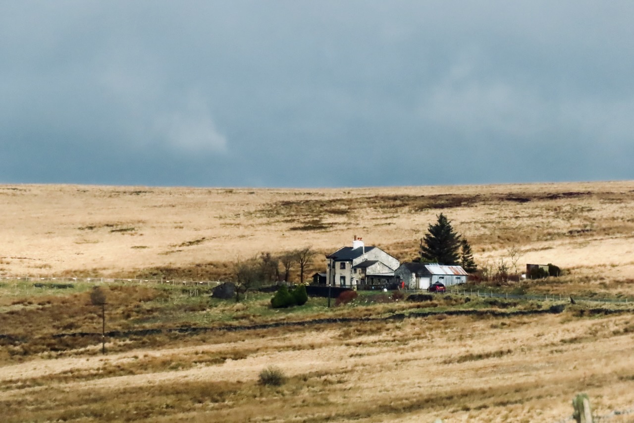
I drive past this house fairly often as it lies on most routes northwards from home. It’s certainly lived in on a permanent basis. I have always admired its glorious isolation, and what it must take to survive in reasonable condition 1,280 feet/380m up in the air in the middle of a peat moor. But would I want to live there myself? Not really. (If you want to check out its position on the Ordnance Survey map it lies at about grid reference SD910286.)
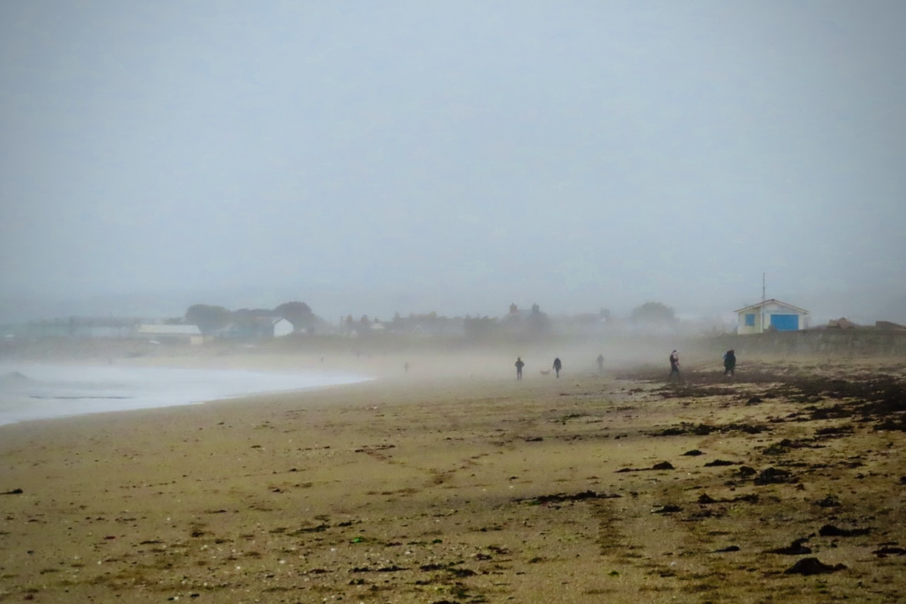
My last full day in Cornwall. Less clement weather as you can see, but all the same, I’d rather have had this than the heavy snow which has hit further north: I’m quite happy to be away from that, thank you very much. A definite ‘sea/beach’ theme has developed, with this being the fifth in a row to feature one or both, but down here, where the island ends, it’s hard to be unaware of the ocean.
Those of you not from Britain might not be immediately aware of the cultural significance of Land’s End, although the very name gives a clue. This is not the southernmost point on the island of Great Britain (that being the Lizard), nor is it the westernmost (Ardnamurchan, in Scotland), but it is the furthest extremity of the long toe that the island sends out into the Atlantic, and the distance of, about, 875 miles in a straight line to John o’Groats in Scotland is the longest distance between any two points on this lump of land off the north-west coast of Europe.
The building you see here, officially known as the “First and Last House”, is a café — with, behind, the Longships lighthouse — and somewhere just to the left is a rather tacky complex of buildings targeted firmly at the very large number of tourists who flock here during the summer months. I consider myself fortunate to have seen it in the off-season. But while at one level it seems very arbitrary to value this point over many others nearby which are far more attractive and interesting (like Porthcurno, yesterday, which is about four miles away [and further south]), there is a sense here that one has come to the end of something, in a quite physical but also a spiritual sense. Which is why people want to come here, I guess. I can’t knock it — I made a point of making it to this spot, and now document it here on the blog. In the grand scheme of things it doesn’t mean anything, but in a small and personal way, perhaps it does.
I said yesterday that Penzance, or more generally this part of the world, has not always been peripheral. On this beach at the tip of Britain, the main trans-Atlantic and international telegraph and, later, telephone cables came on shore, from 1870 onwards. That fact explains why I am here — thanks to the Cable & Wireless training centre (for telegraph operators) being built around this vital connection in the country’s communications network, buildings that nowadays house the archive that I have come down to Cornwall to consult.
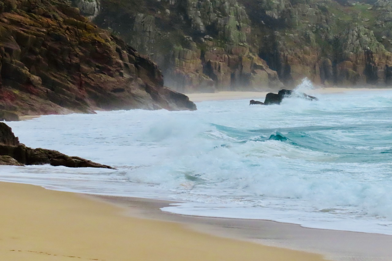
Either way, Porthcurno has a damn fine beach, one that you would never know was such a strategically important spot. This is the southernmost shot I’ve yet taken in England, and as there is only a tiny portion of the country further south than here (just the Lizard peninsula), this sets a record that I may never beat.
It was about time I paid another visit to the Lake District, having missed out on most of the winter, and I was not the only person to be thinking that it was too nice a day to stay indoors. The walkers stand on Knott Rigg, a fairly inconsequential lump that becomes the 306th Wainwright bagged on my second round, so I have 24 to go. In the background, Red Pike.
I notice that this blog, which was started on my 42nd birthday — hence the name — has now reached day 4,200. I am sure that I will think of some way of marking 6th April, which I calculate will be day 4,242.
My last day in London, this time. I did the Thames as a subject on Sunday, but I’m doing it again. A glorious morning: the two walkers seen here, and me, were considerably overdressed. I’m not sure that the bridge ahead has a name, but it takes the suburban line over the river to Chiswick. This is a very attractive part of the city, which is why I will never be able to afford to live there.