Tuesday 4th February 2014, 1.20pm (day 894)
I’ve been stuck in the house for eight days straight. Goddammit, I was getting out today. I may still be contagious but out in a place like this, who cares?
I’ve been stuck in the house for eight days straight. Goddammit, I was getting out today. I may still be contagious but out in a place like this, who cares?
Christmas Eve. Ignoring the typically apocalyptic weather forecast (as I have all year), I went on walk #77 of my Lake District project and despite a breeze that could be called ‘bracing’ and the odd hail shower, I had a thoroughly good time on Scout Scar, a limestone outcrop to the west of Kendal, Cumbria. And managed a couple of decent photos too. The rest will be up on my other blog soon…
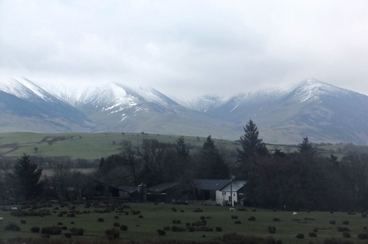
I am not fully certain of the identities of these hills by the way. I think the one on the left is called White Hill, and the horizon is formed by the Three Peaks of Yorkshire, melding into one at this distance but I am sure the step on the right must be that of Pen-y-Ghent or Ingleborough, with Whernside the rise in the ridge in the centre. But I could be wrong.
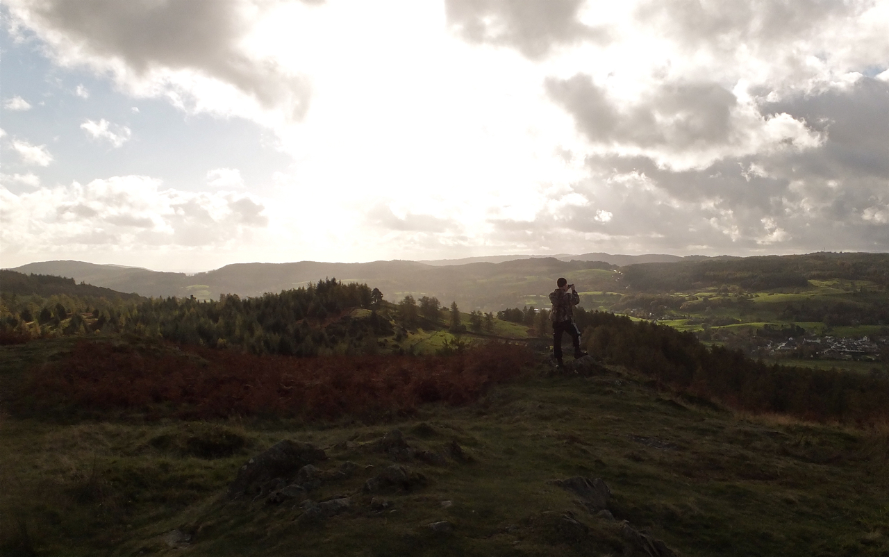
Second day of this two-day break in the Lake District with Joe. I make no apologies for uploading another landscape shot today, though let’s give it that slightly different angle and included in it someone else who was doing their best to capture what was, for a hill only 803 feet above sea level, a quite exceptional panorama. Latterbarrow rises to the north-east of the village of Hawkshead.

Joe is on his half-term holiday, so these two days I’m off work doing my part of the child care duties. And I decided to take him somewhere I liked. Why not.
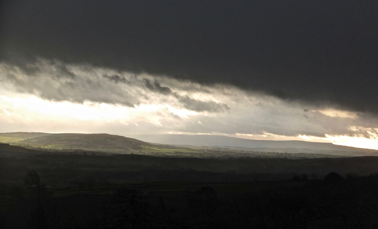
Newspaper editors in London might also like to use this picture as evidence that today was not, despite their headlines, the day that the ‘Killer Storm Stopped Britain’. Or perhaps they were using ‘Britain’ as shorthand for ‘that small part of a decent-sized country which is nearest to London’ — as they so often do?
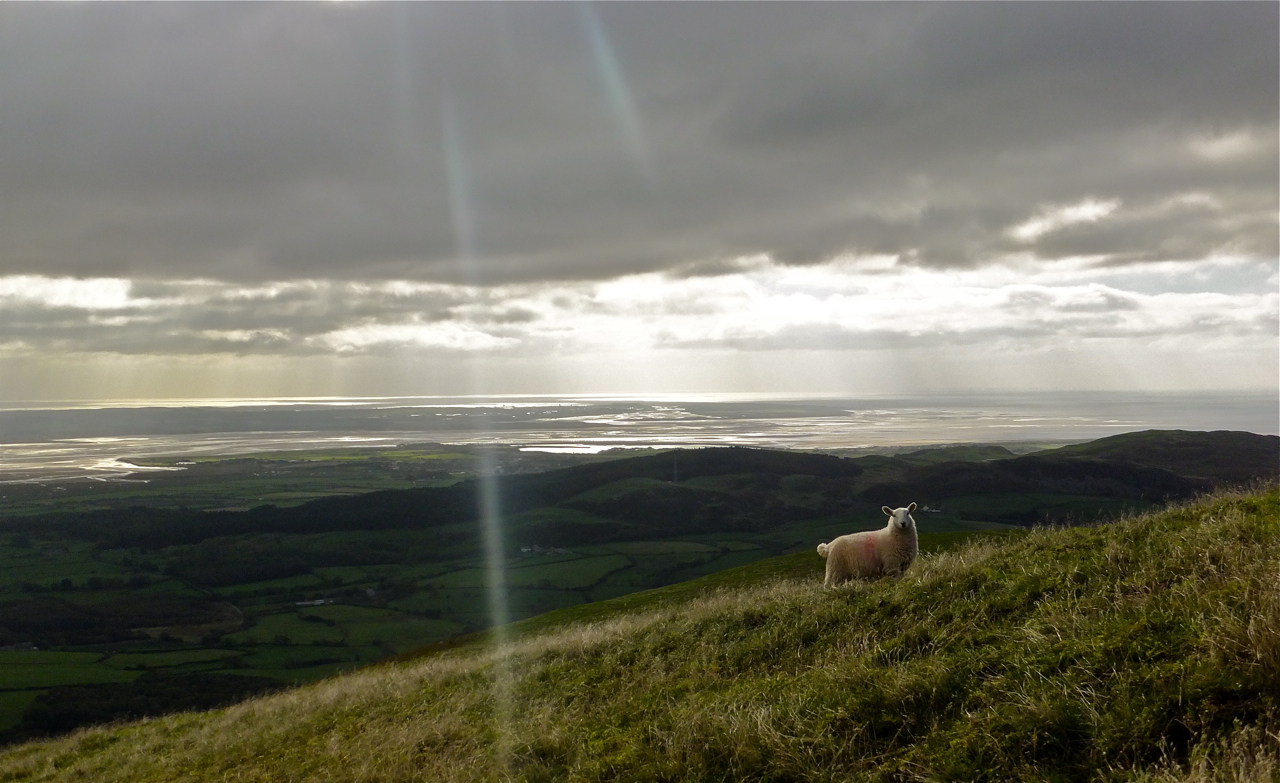
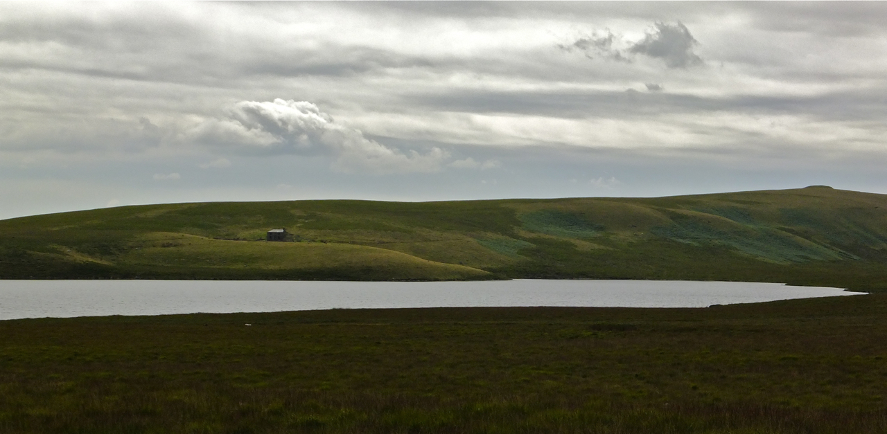
I have worked the last two Sundays and I’m working this coming Sunday too, so today I took the day off and made the most of a decent weather forecast. This is taken in the far south-west corner of the Lake District, looking southeast over the long estuary of the River Duddon, with the town of Barrow on the peninsula in the background. (More pictures from the day will be put on my other blog later.)
Haven’t done a ‘pure’ landscape for a while — not since the last time I was around the Lake District, I guess. Not a coincidence, there are just so many more of them round there.
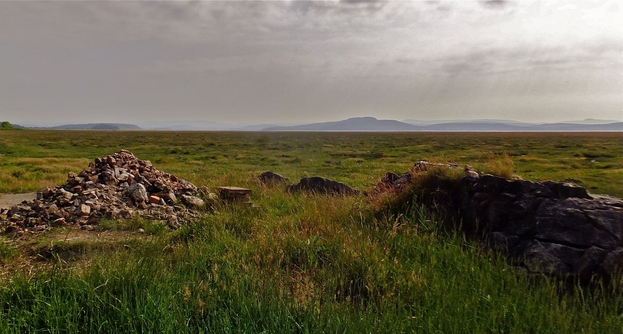
I worked yesterday, so walked today. This is my usual walking county — Cumbria — but so far away from my usual haunt that it’s outside the Lake District National Park, on the very edge of Morecambe Bay. Forty years ago this area was marked on the map as mud and sand, but changes in the currents around the Bay (caused by sea protection works in Morecambe, some say) have seen the sea retreat and leave these salt marshes. There were a few clouds around when I arrived at nearby Kents Bank railway station to start my walk a few minutes before taking this photo, but they soon burned off, and it was another very hot one today.

I’m walking again. If you want to know more about that part of the day then see my other blog. It was a gorgeous, glorious summer’s day, perfect weather in every respect, and this is more-or-less the only picture I took all day that didn’t have some blue skies on it somewhere. But nevertheless it’s the one I like the best: good curve on the wall, the solitary X-shape of the stile.
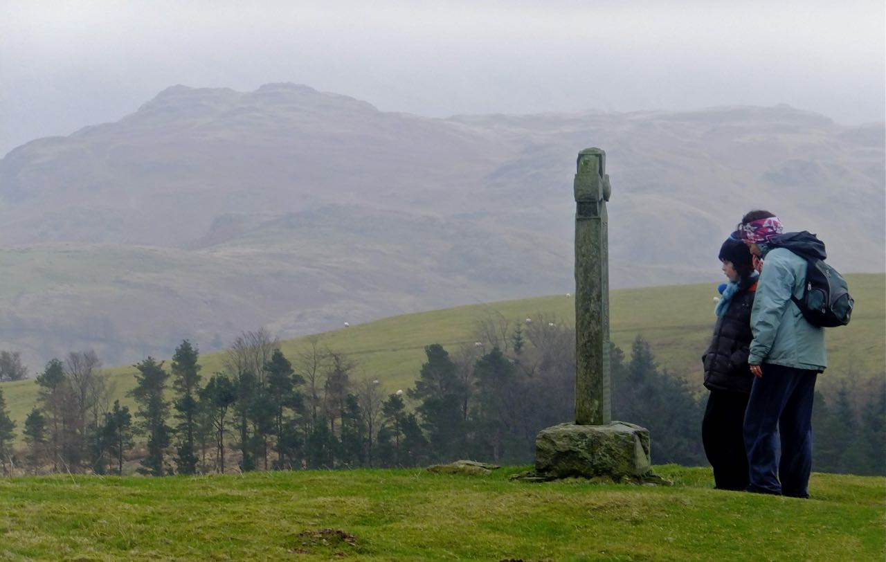
This monument to two shepherds, Edward and Joseph Hawell, stands just above the car park at the end of Gale Road, near Keswick, on the path up to Skiddaw, England’s fourth-highest mountain. But I did not climb Skiddaw today. I (and Clare and Joe, pictured here inspecting the Hawell cross) climbed Lonscale Fell and Latrigg, the gentle green slopes of which are visible behind them (the fell in the far background being High Rigg). Latrigg was the 214th Wainwright fell I have climbed – and there are 214 in total.
So it was the last one. I have completed my project. Well… better find something else to do I suppose.

High Rigg is a low-altitude but craggy hill a few miles to the east of the town of Keswick. On the left of this shot, in the background, is Helvellyn, the third-highest mountain in England. The dark dimple in the middle is called Great How. The lake is Thirlmere, actually a reservoir. This shot was taken with a dark filter on, then I beefed up the highlights to bring out the sun; but this is more-or-less what it looked like on this November morning. A high haze in the sky allowed one to look straight into the sun, and brought out the last of autumn’s rich colours.
And, oh yeah, I’ve now only got 2 of the 214 Wainwright fells left to climb. I’ll get all the pictures up on my other blog tomorrow morning.
